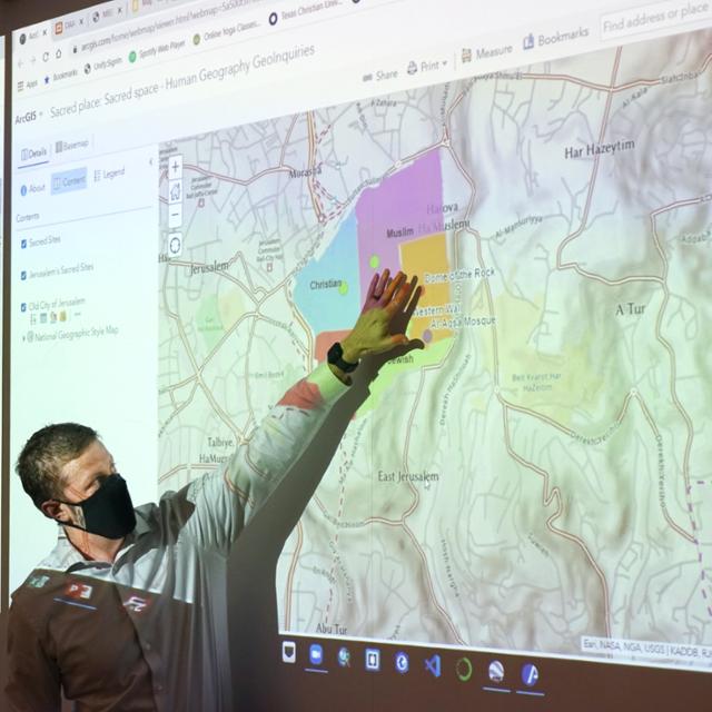
If you’ve ever used your smartphone to search for the location of a restaurant or browse aerial imagery using Google Maps, you were using a technology called Geographic Information Systems (GIS). On the surface, GIS is about maps – but it is so much more than how to get from point A to B.
Today, GIS maps your garbage routes, indicates virus trends and determines supply chain logistics. Those broad uses are on full display at TCU where GIS is implemented in almost every college and school on campus.
This cross-discipline effort will be showcased Nov. 17 as the TCU Neeley School of Business will be a location host to the international GIS Day. Celebrated for the third year on the TCU campus, GIS Day is centered around discovering the world through GIS. The day was founded by Esri, the world’s leading expert in GIS and a TCU Neeley partner.
This year’s GIS Day will feature a panel with Esri and fellow corporate partners Dunaway Associates and H-E-B. The panel also includes a cross-discipline representation from TCU, including Professor of Supply Chain Practice Laura Meade from the Neeley School of Business; Assistant Professor Esayas Gebremichael from the College of Science & Engineering; and Associate Professors Sean Crotty, Xiaolu Zhou and Kyle Walker from the AddRan College of Liberal Arts.
“The panel will be a great opportunity to showcase how GIS is being used and the opportunities for cross-collaboration,” said Jason Byrne, TCU’s senior director of corporate and foundation relations who manages TCU’s partnership with Esri. “Maps tell us a story, and GIS helps to enable those.”
GIS has for years been a part of the TCU Neeley Graduate Supply Chain Case Competition, which awards $20,000 to the top five student teams representing graduate supply chain colleges from across the country.
“The competition is a great way for students from the top 25 Supply Chain graduate programs to showcase their skills and ideas to impress supply chain executives,” said Molly Kanthack, assistant director for the Neeley Corporate Outreach Center for Supply Chain Innovation. “It gives them an opportunity to apply GIS technology on a real case for businesses that need a solution.”
The TCU Neeley School of Business also teaches a supply chain course using the tool. More colleges are scaling up for GIS, either within the college or cross-developmentally, as its potential is better understood.
“It is really infiltrating so much – supply chain, but also neighborhoods and geography and education. I also see it playing a big role in solving global issues such as sustainability,” said Meade.
GIS was first taught by TCU’s geology and environmental science departments. Now, the Department of Geological Sciences offers a GIS Certificate Program, and GIS is being used by faculty and students across departments and programs in the College of Science & Engineering, such as engaging local schoolchildren with geospatial technology and playing a key role in the Michael and Sally McCracken Student Research Symposium.
“In the classroom, I use examples and exercises based on real-world situations and events to demonstrate the practical applications of GIS and other geospatial technology tools,” said Gebremichael, who is also using GIS in his own research on lake levels.
In AddRan, Crotty uses GIS from more technical classes to the Geography of Beer and Wine class. And he sees its potential for cross-discipline use rather limitless.
“Geography is an inherently interdisciplinary field, so it is sort of our collective comfort zone to collaborate across traditional topical and disciplinary boundaries,” he said.
GIS was pioneered in the 1960s, as advances were made with mainframe computers. Later, as computer memory size and graphic capabilities improved, GIS software was developed and chiefly used by governments that recognized digital mapping benefits.
As it commercialized, GIS was used by professionals, such as land managers, urban planners and surveyors – anyone who used maps to define boundaries, roads and utilities. Today, with even more advances in the technology, GIS users come from thousands of fields around the globe, with more on the horizon, thanks to the technology being taught in schools, including TCU.
“This is an exciting time for TCU to be associated with GIS and the differentiator this technology has been and will continue to be in the future,” Byrne said.
Read more about how GIS is being used across campus. Visit the Neeley School of Business, the AddRan College of Liberal Arts and the College of Science & Engineering.
